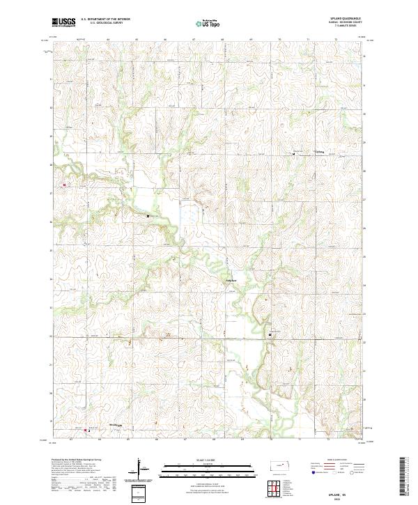
2022 Map of Upland
USGS Topo · Published 2022About this map
Chapman Cr meanders through the heart of this Dickinson County landscape, shaping a terrain defined by the township divisions of t11s r3e, t11s r4e, and t12s r3e. The settlement of Upland anchors the northeast, while Sutphen and Moonlight represent the dispersed rural centers typical of this Kansas prairie region. A network of numbered avenues and named roads, including Nail Road (1600) and Paint Road (1800), follows the grid system established by early land surveys.
Find a feature on this map
41 named features on this map. Tap any name to fly to it.
Don’t see what you’re looking for? This feature index may not catch every label — zoom into the map to look around manually.
Map Details
Editions of this 2022 Upland Map
This is the sole edition of this map. No revisions or reprints were ever made.
Other maps of this area

1886 · Junction City
USGS Topo · 1:125,000

1889 · Junction City
USGS Topo · 1:125,000

1889 · Abilene
USGS Topo · 1:125,000

1889 · Parkerville
USGS Topo · 1:125,000

1891 · Clay Center
USGS Topo · 1:125,000

1894 · Junction City
USGS Topo · 1:125,000

1894 · Abilene
USGS Topo · 1:125,000

1894 · Parkerville
USGS Topo · 1:125,000

1947 · Fort Riley
USGS Topo · 1:62,500

1950 · Alida
USGS Topo · 1:24,000