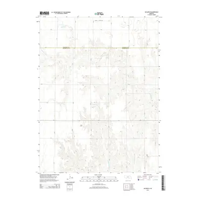
2014 Map of Upland SE
USGS Topo · Published 2014About this map
The Kearney Co Franklin Co line bisects this agricultural landscape, where the headwaters of the Little Blue River carve through the plains. The terrain is defined by the drainage networks of the Middle Br Thompson Cr and E Br Thompson Cr, which create a series of draws and ridges across the southern portion of the quadrangle. Human activity in the early 21st century is marked by a rigorous section-line road grid, including A Rd and 38 Rd, which anchor the rural economy.
Find a feature on this map
22 named features on this map. Tap any name to fly to it.
Don’t see what you’re looking for? This feature index may not catch every label — zoom into the map to look around manually.
Map Details
Editions of this 2014 Upland SE Map
This is the sole edition of this map. No revisions or reprints were ever made.
Other maps of this area

1897 · Red Cloud
USGS Topo · 1:125,000

1940 · Red Cloud
USGS Topo · 1:62,500

1942 · Red Cloud
USGS Topo · 1:62,500

1955 · Grand Island
USGS Topo · 1:250,000

1957 · Grand Island
USGS Topo · 1:250,000

1958 · Grand Island
USGS Topo · 1:250,000

1969 · Upland
USGS Topo · 1:24,000

1969 · Upland SE
USGS Topo · 1:24,000
1969 · Holstein
USGS Topo · 1:24,000
1969 · Campbell
USGS Topo · 1:24,000