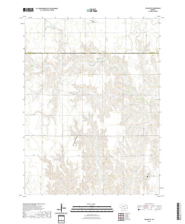
2021 Map of Upland SE
USGS Topo · Published 2021About this map
The Little Blue River cuts across the northern reaches of this rural landscape where the border of Kearney Co and Franklin Co divides the plains. This 2021 topographic survey reveals a terrain defined by the dendritic drainage patterns of the Middle Br Thompson Cr and E Br Thompson Cr, which flow southward through the agricultural grid. Local history is anchored by the presence of Osco Cem in the north and Trinity Lutheran Cem near the southern boundary, markers of the long-standing communities that settled these townships. The map illustrates a strictly ordered section-line road system, with alphanumeric designations such as Osco Rd and S Rd, while the privately owned Sindt Airport serves as a small aviation node within the open farmland. Further north, the Nelson Reservoir stands as a significant water feature amidst the undulating prairie.
Find a feature on this map
24 named features on this map. Tap any name to fly to it.
Don’t see what you’re looking for? This feature index may not catch every label — zoom into the map to look around manually.
Map Details
Editions of this 2021 Upland SE Map
This is the sole edition of this map. No revisions or reprints were ever made.
Other maps of this area

1897 · Red Cloud
USGS Topo · 1:125,000

1940 · Red Cloud
USGS Topo · 1:62,500

1942 · Red Cloud
USGS Topo · 1:62,500

1955 · Grand Island
USGS Topo · 1:250,000

1957 · Grand Island
USGS Topo · 1:250,000

1958 · Grand Island
USGS Topo · 1:250,000

1969 · Upland
USGS Topo · 1:24,000

1969 · Upland SE
USGS Topo · 1:24,000
1969 · Holstein
USGS Topo · 1:24,000
1969 · Campbell
USGS Topo · 1:24,000