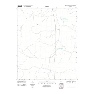
2010 Map of Upper Galestina Canyon
USGS Topo · Published 2010About this map
Upper Galestina Canyon and Guillermo Canyon define the drainage patterns of this high-desert landscape in McKinley County, where water management is central to the land's utility. The presence of the ECW Number 7 Windmill and named water catchments like the Upper Galestina Number One A Reservoir and the Upper Galestina Number 7 Reservoir indicates a focus on supporting livestock or local infrastructure in a traditionally arid region. Transportation across these canyons relies on the network of tribal and regional roads, specifically Indian Service Route 13 and Indian Service Route 8. This 2010 survey illustrates the modern intersection of traditional land use and systematic water engineering, providing a clear record of the essential landmarks that sustain activity in the high canyons.
Find a feature on this map
8 named features on this map. Tap any name to fly to it.
Don’t see what you’re looking for? This feature index may not catch every label — zoom into the map to look around manually.
Map Details
Editions of this 2010 Upper Galestina Canyon Map
This is the sole edition of this map. No revisions or reprints were ever made.
Other maps of this area

1886 · Wingate
USGS Topo · 1:250,000

1892 · Wingate
USGS Topo · 1:250,000

1954 · Saint Johns
USGS Topo · 1:250,000

1954 · Gallup
USGS Topo · 1:250,000

1957 · Saint Johns
USGS Topo · 1:250,000

1958 · Gallup
USGS Topo · 1:250,000

1958 · Saint Johns
USGS Topo · 1:250,000

1959 · Gallup
USGS Topo · 1:250,000

1962 · Gallup
USGS Topo · 1:250,000

1962 · Saint Johns
USGS Topo · 1:250,000