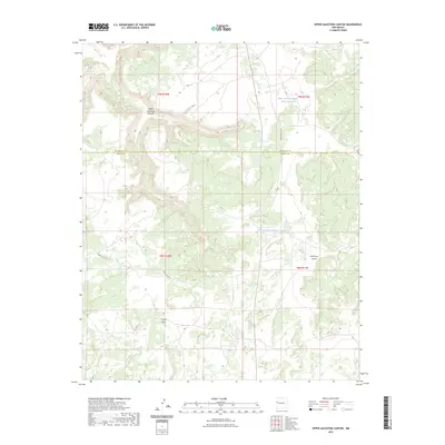
2023 Map of Upper Galestina Canyon
USGS Topo · Published 2023About this map
Upper Galestina Canyon carves through the high desert landscape along the border of McKinley and Cibola counties, anchoring a region defined by dramatic topographic shifts and sparse water management. This contemporary survey documents a remote section of New Mexico where the legacy of land management is visible in infrastructure like the Upper Galestina Number One A Reservoir and the Upper Galestina Number 7 Reservoir. These catchments, along with drainage features such as Trujillo Draw, are essential markers in an arid environment. The map also traces the path of Indian Svc Rte 13 and Indian Svc Rte 8, providing a precise look at the network of service roads that navigate the complex system of canyons, including the eastern Guillermo Canyon.
Find a feature on this map
12 named features on this map. Tap any name to fly to it.
Don’t see what you’re looking for? This feature index may not catch every label — zoom into the map to look around manually.
Map Details
Editions of this 2023 Upper Galestina Canyon Map
This is the sole edition of this map. No revisions or reprints were ever made.
Other maps of this area

1886 · Wingate
USGS Topo · 1:250,000

1892 · Wingate
USGS Topo · 1:250,000

1954 · Saint Johns
USGS Topo · 1:250,000

1954 · Gallup
USGS Topo · 1:250,000

1957 · Saint Johns
USGS Topo · 1:250,000

1958 · Gallup
USGS Topo · 1:250,000

1958 · Saint Johns
USGS Topo · 1:250,000

1959 · Gallup
USGS Topo · 1:250,000

1962 · Gallup
USGS Topo · 1:250,000

1962 · Saint Johns
USGS Topo · 1:250,000