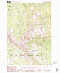
1986 Map of Upper Tepee Basin
USGS Topo · Published 1986About this map
Gallatin National Forest dominates this 1986 survey, showcasing a complex overlap of protected high-altitude landscapes in Gallatin County. The topography is defined by significant peaks like Snowslide Mountain and Monument Mountain in the north, while the Lee Metcalf Wilderness covers much of the central terrain. This map captures the administrative boundaries of the Cabin Creek Wildlife Management Area and the Skyline Wilderness Management Area, reflecting the region's focus on habitat preservation during the late 20th century. Drainage patterns are intricate, with Sage Creek flowing through the west and the Middle Fork Cabin Creek cutting through the south. A prominent Pack Trail serves as the primary corridor for movement across these ridges, linking names like Redstreak Peak and Tepee Point.
Find a feature on this map
28 named features on this map. Tap any name to fly to it.
Don’t see what you’re looking for? This feature index may not catch every label — zoom into the map to look around manually.
Map Details
Editions of this 1986 Upper Tepee Basin Map
2 editions found
Other maps of this area

1888 · Three Forks
USGS Topo · 1:250,000

1894 · Three Forks
USGS Topo · 1:250,000

1895 · Three Forks
USGS Topo · 1:250,000

1947 · Bozeman
USGS Topo · 1:250,000

1948 · Bozeman
USGS Topo · 1:250,000

1950 · Hebgen Dam
USGS Topo · 1:62,500

1950 · Sphinx Mountain
USGS Topo · 1:62,500

1955 · Bozeman
USGS Topo · 1:250,000

1955 · Crown Butte
USGS Topo · 1:62,500

1955 · Ashton
USGS Topo · 1:250,000