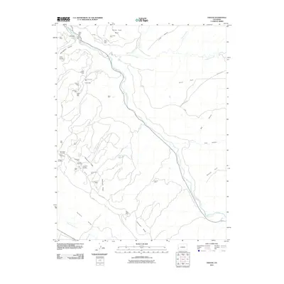
2010 Map of Uravan
USGS Topo · Published 2010About this map
Uravan sits at the northern edge of this high-desert canyon landscape, where the San Miguel River carves through the red rock formations. This 2010 map documents a terrain heavily shaped by historical mineral extraction, featuring a dense network of mining claims concentrated along Sawtooth Ridge and Long Park. Names like the South Blackfoot Mine, Yellow Spot Mine, and Virgin Mine testify to the area's uranium and vanadium mining legacy. The complex topography spans from the flat expanses of Paradox Valley in the south to the heights of Long Mesa. Remote access is provided by a series of primitive routes such as Long Park Rd and AA 18 Rd, which navigate the steep drop-offs into Hieroglyphic Canyon and Box Canyon.
Find a feature on this map
51 named features on this map. Tap any name to fly to it.
Don’t see what you’re looking for? This feature index may not catch every label — zoom into the map to look around manually.
Map Details
Editions of this 2010 Uravan Map
This is the sole edition of this map. No revisions or reprints were ever made.
Other maps of this area

1916 · Paradox Valley
USGS Topo · 1:125,000

1922 · Paradox Valley
USGS Topo · 1:125,000

1948 · Bull Canyon
USGS Topo · 1:24,000

1948 · Uravan
USGS Topo · 1:24,000

1948 · Naturita NW
USGS Topo · 1:24,000

1949 · Bull Canyon
USGS Topo · 1:24,000

1949 · Davis Mesa
USGS Topo · 1:24,000

1949 · Uravan
USGS Topo · 1:24,000

1949 · Naturita NW
USGS Topo · 1:24,000

1949 · Atkinson Creek
USGS Topo · 1:24,000