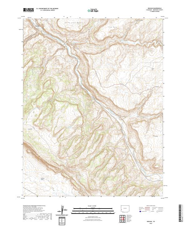
2022 Map of Uravan
USGS Topo · Published 2022About this map
The settlement of Uravan sits at a narrow point of the San Miguel River valley, surrounded by the high, flat-topped terrain of Spring Creek Mesa and Wild Cow Mesa. This 2022 survey documents a landscape defined by deep incisions and high ridges, including the prominent Sawtooth Ridge and the broad Paradox Valley to the south. Historically significant for its industrial heritage, the area's geography is marked by numerous canyons such as Coal Canyon and Box Canyon, alongside water sources like Horsethief Spring. Local access is maintained through a network of secondary roads including ee22 RD and V19 Road Trl, which navigate the complex elevation changes between the river basin and the surrounding parks, such as Third Park and Second Park. The drainage patterns of Tabeguache Cr and Spring Cr further illustrate the rugged hydrological network that has shaped the human and natural history of this Montrose County region.
Find a feature on this map
67 named features on this map. Tap any name to fly to it.
Don’t see what you’re looking for? This feature index may not catch every label — zoom into the map to look around manually.
Map Details
Editions of this 2022 Uravan Map
This is the sole edition of this map. No revisions or reprints were ever made.
Other maps of this area

1916 · Paradox Valley
USGS Topo · 1:125,000

1922 · Paradox Valley
USGS Topo · 1:125,000

1948 · Bull Canyon
USGS Topo · 1:24,000

1948 · Uravan
USGS Topo · 1:24,000

1948 · Naturita NW
USGS Topo · 1:24,000

1949 · Bull Canyon
USGS Topo · 1:24,000

1949 · Davis Mesa
USGS Topo · 1:24,000

1949 · Uravan
USGS Topo · 1:24,000

1949 · Naturita NW
USGS Topo · 1:24,000

1949 · Atkinson Creek
USGS Topo · 1:24,000