
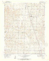
1951 Map of Urbana
USGS Topo · Published 1951About this map
Urbana serves as the central hub of this Missouri Ozarks landscape, where the primary north-south corridor connects rural communities just after the mid-century. The map captures a detailed transition of the terrain as it crosses multiple county lines, including Hickory Co Dallas Co and Dallas Co Polk Co. The social fabric of the era is anchored by small country institutions such as Pleasant Ridge Ch, Hopewell Ch, and the Star Ridge Sch, reflecting a time when neighborhood schools and churches were the primary centers of local life. Drainage systems like Cahoonchie Creek and Ingalls Creek dictate the road patterns and farm placements across the townships of Lincoln and Green. To the south, the village of Louisburg and the hamlet of Rimby mark the lower reaches of the survey, providing a precise record of these settlements before modern development altered their scale.
Find a feature on this map
27 named features on this map. Tap any name to fly to it.
Don’t see what you’re looking for? This feature index may not catch every label — zoom into the map to look around manually.
Map Details
Editions of this 1951 Urbana Map
2 editions found
Other maps of this area

1884 · Bolivar
USGS Topo · 1:125,000

1892 · Bolivar
USGS Topo · 1:125,000

1949 · Sentinel
USGS Topo · 1:24,000

1950 · Sentinel
USGS Topo · 1:24,000

1950 · Buffalo NW
USGS Topo · 1:24,000

1950 · Polk
USGS Topo · 1:24,000

1950 · Urbana
USGS Topo · 1:24,000

1951 · Buffalo NW
USGS Topo · 1:24,000

1951 · Polk
USGS Topo · 1:24,000
1951 · Hermitage
USGS Topo · 1:62,500