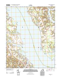
2013 Map of Urbanna
USGS Topo · Published 2013About this map
The Rappahannock River dominates this coastal landscape, serving as the central artery between Middlesex and Lancaster counties. Along its southern bank, the historic port town of Urbanna is detailed with its waterfront Urbanna Wharf and the nearby Rosegill Farm Airstrip. The map illustrates a complex network of tidewater inlets and points, from the secluded Glebe Pond to the prominent Corrotoman Neck across the water. On the northern shore, small communities such as Monaskon, Mollusk, and Ottoman are connected by River Rd, reflecting the enduring rural character of the Northern Neck. Boating infrastructure is evident at the Greenvale Creek Marina, while the eastern edge is defined by the marshy reaches of Lawsons Island and Towles Point. This survey captures the region's balance of established maritime heritage and modern recreational aviation and boating.
Find a feature on this map
73 named features on this map. Tap any name to fly to it.
Don’t see what you’re looking for? This feature index may not catch every label — zoom into the map to look around manually.
Map Details
Editions of this 2013 Urbanna Map
This is the sole edition of this map. No revisions or reprints were ever made.
Other maps of this area

1916 · Kilmarnock
USGS Topo · 1:48,000

1917 · Heathsville
USGS Topo · 1:48,000

1917 · Urbanna
USGS Topo · 1:62,500

1917 · Morattico
USGS Topo · 1:62,500

1917 · Kilmarnock
USGS Topo · 1:62,500

1918 · Morattico
USGS Topo · 1:62,500

1926 · Morattico
USGS Topo · 1:62,500

1942 · Kilmarnock
USGS Topo · 1:62,500

1943 · Richmond
USGS Topo · 1:250,000

1944 · Morattico
USGS Topo · 1:31,680