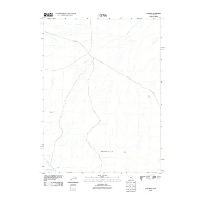
2011 Map of Utah Peak
USGS Topo · Published 2011About this map
Ferber Hills and the prominent Utah Peak define this desert landscape on the border of Utah and Nevada. The area is marked by a network of drainage channels, most notably Ferber Wash, which feeds toward Ferber Reservoir Number One at the southern edge of the quadrangle. This 2011 survey illustrates a quiet, arid terrain where human infrastructure is limited to long-distance routes like Ibapah Rd and isolated industrial markers such as Owl Hill Well Number 1. This map is particularly useful for those tracking land use and water management in Tooele County, as it shows the relationship between natural landmarks like Rocky Point and the sparse water sources and roads that allow for transit through this high-altitude basin.
Find a feature on this map
7 named features on this map. Tap any name to fly to it.
Don’t see what you’re looking for? This feature index may not catch every label — zoom into the map to look around manually.
Map Details
Editions of this 2011 Utah Peak Map
This is the sole edition of this map. No revisions or reprints were ever made.
Other maps of this area

1925 · Gold Hill
USGS Topo · 1:62,500

1928 · Gold Hill
USGS Topo · 1:62,500

1953 · Tooele
USGS Topo · 1:250,000

1955 · Tooele
USGS Topo · 1:250,000

1955 · Elko
USGS Topo · 1:250,000

1958 · Elko
USGS Topo · 1:250,000

1962 · Elko
USGS Topo · 1:250,000

1965 · Elko
USGS Topo · 1:250,000

1972 · Ferguson Flat
USGS Topo · 1:24,000

1972 · White Horse Pass
USGS Topo · 1:24,000