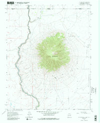
1963 Map of Ute Mountain
USGS Topo · Published 1984About this map
Ute Mountain dominates this high-altitude landscape on the border of New Mexico and Colorado, rising sharply as a volcanic landmark east of the Rio Grande. The river itself is deeply incised within the Canon Del Rio Grande, winding along the western edge of the quadrangle. This 1960s-era survey documents the intersection of natural topography and land management, showing the Grant Boundary and the state line where Costilla Creek flows from the north.
Find a feature on this map
11 named features on this map. Tap any name to fly to it.
Don’t see what you’re looking for? This feature index may not catch every label — zoom into the map to look around manually.
Map Details
Editions of this 1963 Ute Mountain Map
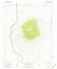
Other maps of this area

1954 · Raton
USGS Topo · 1:250,000

1954 · Trinidad
USGS Topo · 1:250,000

1955 · Trinidad
USGS Topo · 1:250,000

1958 · Raton
USGS Topo · 1:250,000

1958 · Trinidad
USGS Topo · 1:250,000

1959 · Trinidad
USGS Topo · 1:250,000

1963 · Costilla
USGS Topo · 1:24,000

1963 · Cerro De La Olla
USGS Topo · 1:24,000

1963 · Cerro
USGS Topo · 1:24,000

1963 · Ute Mountain
USGS Topo · 1:24,000