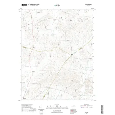
2019 Map of Utica
USGS Topo · Published 2019About this map
Utica and Livia stand as central points in this Western Kentucky landscape, where the borders of McLean, Daviess, and Ohio counties converge. The geography is defined by a dense network of watercourses, including Buck Cr, Twomile Cr, and the winding Rough River along the southern edge. The distribution of small settlements like Maxwell, Nuckols, and Heflin suggests a rural economy tied to the land and local transit, with numerous secondary roads like Harmons Ferry Rd and Briarfield Schoolhouse Rd linking family farms and former community centers. Notable terrain features such as Backbone Ridge and Tucker Hollow provide natural landmarks for those tracing local history. The presence of the Atherton Cem and the small Bigger (STOL) Airport further highlights the varied land use in this pocket of the Green River region.
Find a feature on this map
64 named features on this map. Tap any name to fly to it.
Don’t see what you’re looking for? This feature index may not catch every label — zoom into the map to look around manually.
Map Details
Editions of this 2019 Utica Map
This is the sole edition of this map. No revisions or reprints were ever made.
Other maps of this area

1906 · Sutherland
USGS Topo · 1:62,500

1907 · Whitesville
USGS Topo · 1:62,500

1909 · Whitesville
USGS Topo · 1:62,500

1909 · Hartford
USGS Topo · 1:62,500

1909 · Central City
USGS Topo · 1:62,500

1952 · Equality
USGS Topo · 1:24,000

1952 · Livermore
USGS Topo · 1:24,000

1953 · Philpot
USGS Topo · 1:24,000

1953 · Sutherland
USGS Topo · 1:24,000

1953 · Utica
USGS Topo · 1:24,000