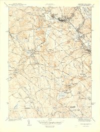
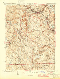
1944 Map of Uxbridge
USGS Topo · Published 1944About this map
The Blackstone River corridor defines the industrial and social landscape of this Worcester County region during the early 1940s. Centered on the textile-rich valley, the map reveals the dense settlement patterns of Whitinsville, Linwood, and Uxbridge, where the historic Blackstone Canal and the New York New Haven and Hartford railroad provided the vital infrastructure for local manufacturing. The map detail extends to the company housing of New Village and the recreational grounds of the Whitinsville Country Club.
Find a feature on this map
95 named features on this map. Tap any name to fly to it.
Don’t see what you’re looking for? This feature index may not catch every label — zoom into the map to look around manually.
Map Details
Editions of this 1944 Uxbridge Map
5 editions found
Other maps of this area

1886 · Blackstone
USGS Topo · 1:62,500

1889 · Blackstone
USGS Topo · 1:62,500

1889 · Webster
USGS Topo · 1:62,500

1889 · Putnam
USGS Topo · 1:62,500

1889 · Burrillville
USGS Topo · 1:62,500

1892 · Webster
USGS Topo · 1:62,500

1893 · Putnam
USGS Topo · 1:62,500

1893 · Blackstone
USGS Topo · 1:62,500

1894 · Burrillville
USGS Topo · 1:62,500

1900 · Blackstone
USGS Topo · 1:62,500