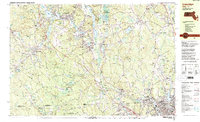
1982 Map of Uxbridge
USGS Topo · Published 1984About this map
Industrial hamlets and riverside settlements define the character of this 1982 survey of the Blackstone Valley corridor. The Blackstone River and Mumford River serve as the primary axes for development, with centers like Whitinsville, Uxbridge, and Millville showing dense residential and institutional footprints. The influence of regional transit is clear along the Providence and Worcester RR, which parallels the waterway through the heart of Blackstone.
Find a feature on this map
159 named features on this map. Tap any name to fly to it.
Don’t see what you’re looking for? This feature index may not catch every label — zoom into the map to look around manually.
Map Details
Editions of this 1982 Uxbridge Map
This is the sole edition of this map. No revisions or reprints were ever made.
Other maps of this area

1886 · Blackstone
USGS Topo · 1:62,500

1887 · Franklin
USGS Topo · 1:62,500

1887 · Providence
USGS Topo · 1:62,500

1889 · Providence
USGS Topo · 1:62,500

1889 · Blackstone
USGS Topo · 1:62,500

1889 · Webster
USGS Topo · 1:62,500

1889 · Franklin
USGS Topo · 1:62,500

1889 · Putnam
USGS Topo · 1:62,500

1889 · Burrillville
USGS Topo · 1:62,500

1892 · Webster
USGS Topo · 1:62,500