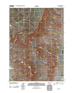
2011 Map of V Lake
USGS Topo · Published 2011About this map
High desert ranching and water management define this Harney County landscape, centered on the drainage systems feeding toward the Alvord Basin. Chet Curry Ranch and Blair Ranch anchor the human presence in this remote eastern Oregon territory, where seasonal water flow is captured by infrastructure like Bingo Reservoir, Bango Reservoir, and Skull Creek Reservoir. The terrain is marked by distinct geological features, from the prominence of Whisky Hill and The Butte to the high elevations of The Peaks in the south.
Find a feature on this map
26 named features on this map. Tap any name to fly to it.
Don’t see what you’re looking for? This feature index may not catch every label — zoom into the map to look around manually.
Map Details
Editions of this 2011 V Lake Map
This is the sole edition of this map. No revisions or reprints were ever made.
Other maps of this area

1955 · Adel
USGS Topo · 1:250,000

1957 · Adel
USGS Topo · 1:250,000

1958 · Adel
USGS Topo · 1:250,000

1962 · Adel
USGS Topo · 1:250,000

1968 · Roaring Springs SE
USGS Topo · 1:24,000

1968 · Alvord Hot Springs
USGS Topo · 1:24,000

1968 · Ankle Creek
USGS Topo · 1:24,000

1971 · Fields Basin
USGS Topo · 1:24,000

1971 · Andrews
USGS Topo · 1:24,000

1971 · V Lake
USGS Topo · 1:24,000