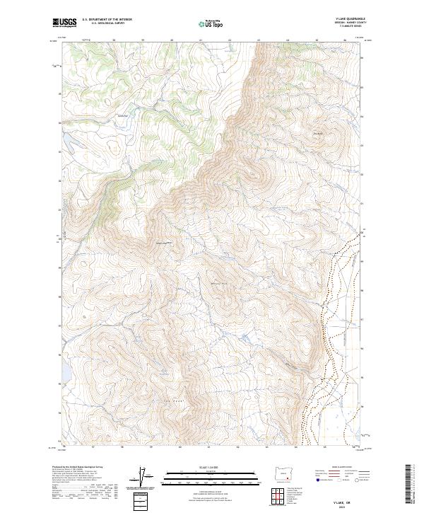
2023 Map of V Lake
USGS Topo · Published 2023About this map
Steens Mountain Wilderness dominates this high-desert landscape in Harney County, showcasing a dramatic transition from the plateau of Smith Flat to the prominent heights of The Peaks and Whisky Hill. This 2023 survey illustrates the critical water management of the region, where livestock and wildlife depend on isolated points like Bingo Reservoir and Twin Springs. The eastern portion of the map is defined by a network of drainage systems, including Andrews Creek and Miranda Creek, which cut through the steep topography. Access to this remote environment is primarily provided by the Fields-Denio Rd along the eastern margin. The map provides a detailed view of the complex land divisions across townships and ranges, marking the intersection of conservation areas and the traditional ranching geography of eastern Oregon.
Find a feature on this map
29 named features on this map. Tap any name to fly to it.
Don’t see what you’re looking for? This feature index may not catch every label — zoom into the map to look around manually.
Map Details
Editions of this 2023 V Lake Map
This is the sole edition of this map. No revisions or reprints were ever made.
Other maps of this area

1955 · Adel
USGS Topo · 1:250,000

1957 · Adel
USGS Topo · 1:250,000

1958 · Adel
USGS Topo · 1:250,000

1962 · Adel
USGS Topo · 1:250,000

1968 · Roaring Springs SE
USGS Topo · 1:24,000

1968 · Alvord Hot Springs
USGS Topo · 1:24,000

1968 · Ankle Creek
USGS Topo · 1:24,000

1971 · Fields Basin
USGS Topo · 1:24,000

1971 · Andrews
USGS Topo · 1:24,000

1971 · V Lake
USGS Topo · 1:24,000