1991 Map of Val Verde
USGS Topo · Published 1995About this map
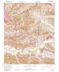
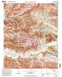
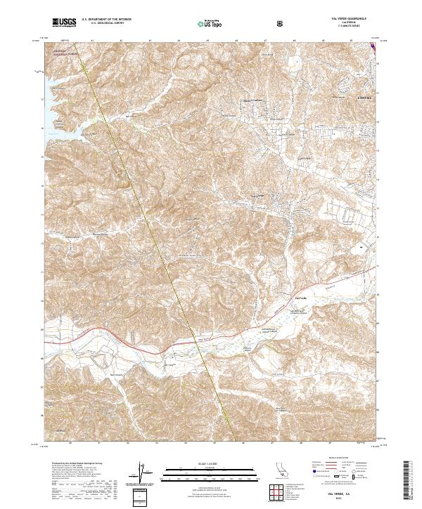
Oil production dominates the landscape of this northwestern corner of Los Angeles County, where industrial infrastructure meets the steep canyons of the Santa Susana Mountains. The terrain is marked by extensive energy operations, including the Ramona Oil Field, the Oak Canyon Oil Field, and the Newhall Potrero Oil Field, all defined by numerous oil wells and sumps scattered across the hillsides. Settlement is concentrated in the small community of Val Verde and scattered family operations such as Hathaway Ranch and Stanley Ranch.
Find a feature on this map
45 named features on this map. Tap any name to fly to it.
Don’t see what you’re looking for? This feature index may not catch every label — zoom into the map to look around manually.
Map Details
Editions of this 1991 Val Verde Map
This is the sole edition of this map. No revisions or reprints were ever made.
Historical Maps of Val Verde Through Time
7 maps found