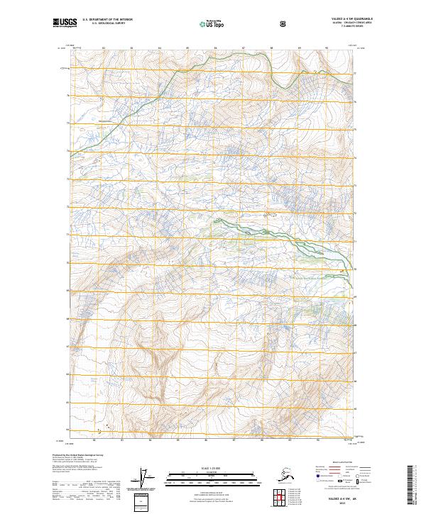
2023 Map of Valdez A-4 SW
USGS Topo · Published 2023About this map
The Chugach National Forest encompasses much of this 2023 landscape, where the Chugach Mountains create a dramatic divide between glacial drainage systems. The northern reaches are shaped by the Lowe River and the high point of Marshall Pass, a historically significant corridor through the mountains. Moving south, the terrain is dominated by massive ice features including the Marshall Glacier and Tasnuna Glacier, which feed the sprawling braided network of the Tasnuna River. The map highlights the complex relationship between alpine ice fields and the active river valleys they carve, showing a wilderness largely untouched by permanent human structures or roads outside of these natural pathways.
Find a feature on this map
11 named features on this map. Tap any name to fly to it.
Don’t see what you’re looking for? This feature index may not catch every label — zoom into the map to look around manually.
Map Details
Editions of this 2023 Valdez A-4 SW Map
This is the sole edition of this map. No revisions or reprints were ever made.
Other maps of this area

1948 · Cordova
USGS Topo · 1:250,000

1950 · Cordova D-5
USGS Topo · 1:63,360

1951 · Cordova
USGS Topo · 1:250,000

1951 · Cordova D-4
USGS Topo · 1:63,360

1952 · Valdez
USGS Topo · 1:250,000

1953 · Cordova D-5
USGS Topo · 1:63,360

1953 · Cordova D-4
USGS Topo · 1:63,360

1953 · Valdez A-4
USGS Topo · 1:63,360

1953 · Valdez A-5
USGS Topo · 1:63,360

1959 · Cordova
USGS Topo · 1:250,000