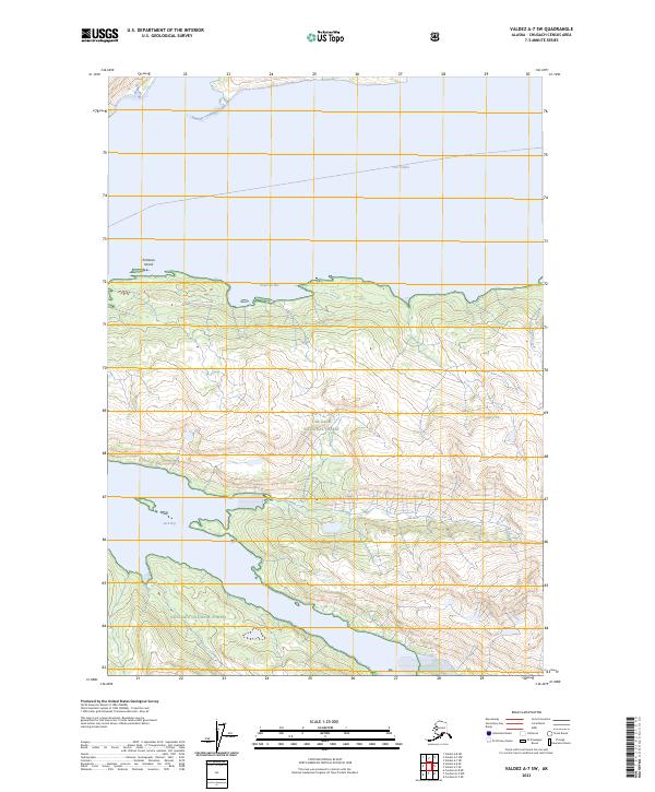
2023 Map of Valdez A-7 SW
USGS Topo · Published 2023About this map
Chugach National Forest encompasses the vast majority of this maritime landscape, where the coastal mountains of Alaska meet the sea. The map details the complex shoreline of Port Valdez to the north and the deep indent of Jack Bay to the south. This terrain is characterized by dramatic elevation changes rising directly from the water's edge, punctuated only by small drainage features like Salmon Creek on the eastern edge. A tiny navigational landmark, Entrance Island, sits at the mouth of the bay, marking the transition from open water to the sheltered coastal reaches. This 2023 edition provides a modern look at the protected wilderness of the Prince William Sound region, focusing on the natural hydrography and topographical contours rather than human settlement.
Find a feature on this map
11 named features on this map. Tap any name to fly to it.
Don’t see what you’re looking for? This feature index may not catch every label — zoom into the map to look around manually.
Map Details
Editions of this 2023 Valdez A-7 SW Map
This is the sole edition of this map. No revisions or reprints were ever made.
Other maps of this area

1948 · Cordova
USGS Topo · 1:250,000

1950 · Cordova D-7
USGS Topo · 1:63,360

1951 · Cordova
USGS Topo · 1:250,000

1951 · Cordova D-8
USGS Topo · 1:63,360

1952 · Valdez
USGS Topo · 1:250,000

1952 · Cordova D-8
USGS Topo · 1:63,360

1952 · Cordova D-7
USGS Topo · 1:63,360

1959 · Cordova
USGS Topo · 1:250,000

1960 · Valdez A-8
USGS Topo · 1:63,360

1960 · Valdez A-7
USGS Topo · 1:63,360