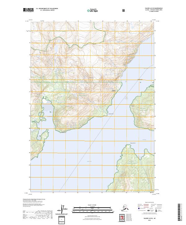
2023 Map of Valdez A-8 SE
USGS Topo · Published 2023About this map
Glacial ice and deep coastal fjords define this portion of the Chugach National Forest near the modern-day settlement of Valdez. The topography is dominated by massive ice fields, including Westbrook Glacier, Annin Glacier, and Anderson Glacier, which overlook the steep drainage of Twin Falls Creek. This landscape shows the maritime intersection of the Valdez Arm and Port Valdez, connected by the strategically narrow passage at Valdez Narrows.
Find a feature on this map
24 named features on this map. Tap any name to fly to it.
Don’t see what you’re looking for? This feature index may not catch every label — zoom into the map to look around manually.
Map Details
Editions of this 2023 Valdez A-8 SE Map
This is the sole edition of this map. No revisions or reprints were ever made.
Other maps of this area

1948 · Cordova
USGS Topo · 1:250,000

1950 · Cordova D-7
USGS Topo · 1:63,360

1951 · Cordova
USGS Topo · 1:250,000

1951 · Cordova D-8
USGS Topo · 1:63,360

1952 · Valdez
USGS Topo · 1:250,000

1952 · Cordova D-8
USGS Topo · 1:63,360

1952 · Cordova D-7
USGS Topo · 1:63,360

1959 · Cordova
USGS Topo · 1:250,000

1960 · Valdez A-8
USGS Topo · 1:63,360

1960 · Valdez A-7
USGS Topo · 1:63,360