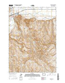
2017 Map of Vale East
USGS Topo · Published 2017About this map
The town of Vale serves as a central hub for this eastern Oregon landscape, where the Malheur River and Willow Cr converge amidst a sophisticated network of irrigation infrastructure. This 2017 survey details the complex system of the Nevada Canal, Mill Ditch, and numerous drains and laterals that support agriculture in the high desert. Local history is anchored by the Pioneer Cem and Valley View Cem, while the geothermal character of the region is noted at Vale Hot Springs.
Find a feature on this map
67 named features on this map. Tap any name to fly to it.
Don’t see what you’re looking for? This feature index may not catch every label — zoom into the map to look around manually.
Map Details
Editions of this 2017 Vale East Map
This is the sole edition of this map. No revisions or reprints were ever made.
Other maps of this area

1906 · Mitchell Butte
USGS Topo · 1:125,000

1950 · Jamieson
USGS Topo · 1:62,500

1951 · Malheur Butte
USGS Topo · 1:24,000

1951 · Moores Hollow
USGS Topo · 1:62,500

1955 · Baker
USGS Topo · 1:250,000

1955 · Boise
USGS Topo · 1:250,000

1958 · Boise
USGS Topo · 1:250,000

1959 · Baker
USGS Topo · 1:250,000

1962 · Boise
USGS Topo · 1:250,000
1967 · Vale East
USGS Topo · 1:24,000