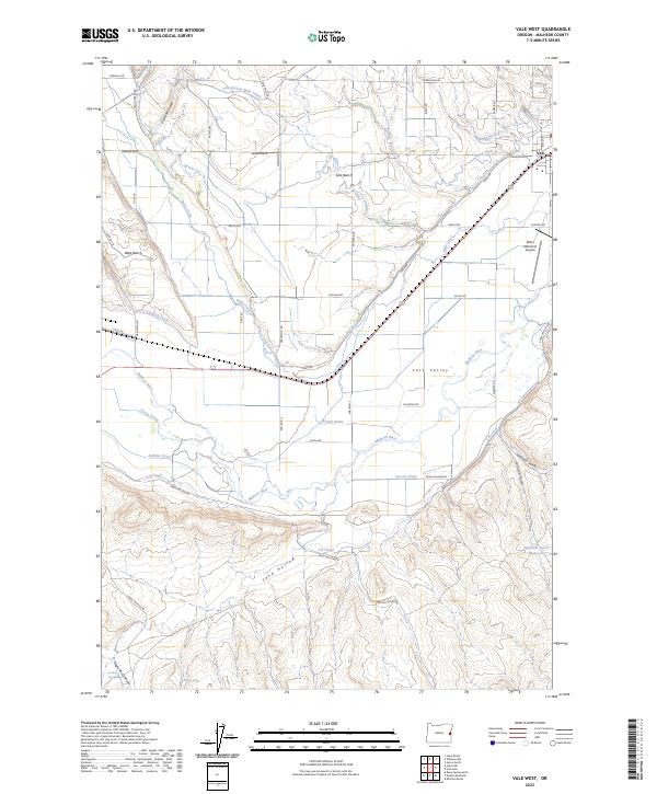
2023 Map of Vale West
USGS Topo · Published 2023About this map
Malheur River irrigation networks define the agricultural landscape west of Vale, where a sophisticated system of canals and drains sustains the Vale Valley. This 2023 survey illustrates the complex water management essential to the high desert, featuring the Vale-Oregon Main Canal, Farmers Ditch, and J-H Canal. The terrain transitions from the low-lying valley floor to elevated plateaus like West Bench and East Bench, punctuated by deep incisions like Negro Rock Canyon and Jamieson Gulch. Local aviation history is anchored by the Miller Memorial Airpark near the eastern edge. For the local researcher, the map preserves the names of numerous specific water features such as Purvis Drain, Russell Drain, and Oil Well Spring, providing a precise record of how the land has been subdivided and utilized for ranching and farming.
Find a feature on this map
54 named features on this map. Tap any name to fly to it.
Don’t see what you’re looking for? This feature index may not catch every label — zoom into the map to look around manually.
Map Details
Editions of this 2023 Vale West Map
This is the sole edition of this map. No revisions or reprints were ever made.
Other maps of this area

1906 · Mitchell Butte
USGS Topo · 1:125,000

1950 · Jamieson
USGS Topo · 1:62,500

1951 · Moores Hollow
USGS Topo · 1:62,500

1955 · Baker
USGS Topo · 1:250,000

1955 · Boise
USGS Topo · 1:250,000

1958 · Boise
USGS Topo · 1:250,000

1959 · Baker
USGS Topo · 1:250,000

1962 · Boise
USGS Topo · 1:250,000
1967 · Vale East
USGS Topo · 1:24,000
1967 · Vines Hill
USGS Topo · 1:24,000