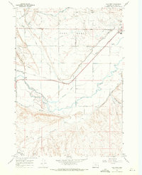
1967 Map of Vale West
USGS Topo · Published 1971About this map
The Malheur River and Bully Creek dominate this landscape west of Vale, Oregon, where a complex irrigation network of canals and ditches sustained mid-century agriculture. The Union Pacific railroad tracks bisect the territory, connecting the small settlement of Hope to the regional hub. Highlighting the engineering of the high desert, the Vale Oregon Canal and Farmers Ditch draw from the river, supported by a Diversion Dam that managed water flow through the arid West Bench and East Bench plateaus.
Find a feature on this map
31 named features on this map. Tap any name to fly to it.
Don’t see what you’re looking for? This feature index may not catch every label — zoom into the map to look around manually.
Map Details
Editions of this 1967 Vale West Map
This is the sole edition of this map. No revisions or reprints were ever made.
Other maps of this area

1906 · Mitchell Butte
USGS Topo · 1:125,000

1950 · Jamieson
USGS Topo · 1:62,500

1951 · Moores Hollow
USGS Topo · 1:62,500

1955 · Baker
USGS Topo · 1:250,000

1955 · Boise
USGS Topo · 1:250,000

1958 · Boise
USGS Topo · 1:250,000

1959 · Baker
USGS Topo · 1:250,000

1962 · Boise
USGS Topo · 1:250,000
1967 · Vale East
USGS Topo · 1:24,000
1967 · Vines Hill
USGS Topo · 1:24,000