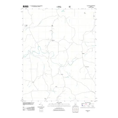
2010 Map of Valeene
USGS Topo · Published 2010About this map
Patoka River and its intricate drainage system define the landscape of southeastern Orange County on this 2010 topographic survey. Small settlements and rural road networks connect the primary communities of Valeene and Bacon, showing the persistence of the area's agrarian roots. The map is particularly useful for genealogical research, documenting several burial sites including the Little Africa Cemetery and Danners Cemetery near the northern boundary, as well as the Purkhiser Cemetery located south of the river.
Find a feature on this map
27 named features on this map. Tap any name to fly to it.
Don’t see what you’re looking for? This feature index may not catch every label — zoom into the map to look around manually.
Map Details
Editions of this 2010 Valeene Map
This is the sole edition of this map. No revisions or reprints were ever made.
Other maps of this area

1947 · Hardinsburg
USGS Topo · 1:24,000

1948 · Milltown
USGS Topo · 1:24,000

1949 · Hardinsburg
USGS Topo · 1:24,000

1950 · Valeene
USGS Topo · 1:24,000

1950 · English
USGS Topo · 1:24,000

1951 · French Lick
USGS Topo · 1:24,000

1956 · Greenbrier
USGS Topo · 1:24,000

1956 · Taswell
USGS Topo · 1:24,000

1956 · Vincennes
USGS Topo · 1:250,000

1957 · Vincennes
USGS Topo · 1:250,000