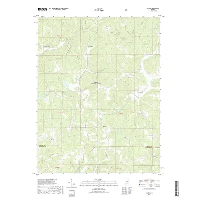
2019 Map of Valeene
USGS Topo · Published 2019About this map
Hoosier National Forest dominates the central topography of this Southern Indiana landscape, where the deeply carved drainages of the Patoka River and Youngs Creek define the settlement patterns. The map highlights several small rural communities and named crossroads such as Valeene, Pearsontown, and Bacon, which are connected by a network of forest roads and trails. Genealogists and local historians will find significant value in the documentation of several family and community burial grounds, including Little Africa Cem, Danners Chapel Cem, and Cook - Tucker Cem. The terrain is characterized by intricate hollows like Underwood Hollow and Bird Hollow, illustrating the rugged drainage systems that feed into Timberlin Lake and various creeks near the Orange and Crawford County line.
Find a feature on this map
41 named features on this map. Tap any name to fly to it.
Don’t see what you’re looking for? This feature index may not catch every label — zoom into the map to look around manually.
Map Details
Editions of this 2019 Valeene Map
This is the sole edition of this map. No revisions or reprints were ever made.
Other maps of this area

1947 · Hardinsburg
USGS Topo · 1:24,000

1948 · Milltown
USGS Topo · 1:24,000

1949 · Hardinsburg
USGS Topo · 1:24,000

1950 · Valeene
USGS Topo · 1:24,000

1950 · English
USGS Topo · 1:24,000

1951 · French Lick
USGS Topo · 1:24,000

1956 · Greenbrier
USGS Topo · 1:24,000

1956 · Taswell
USGS Topo · 1:24,000

1956 · Vincennes
USGS Topo · 1:250,000

1957 · Vincennes
USGS Topo · 1:250,000