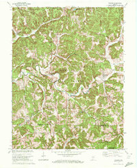
1970 Map of Valeene
USGS Topo · Published 1972About this map
The Initial Point Historical Monument stands as a focal point of this 1970 survey, marking the intersection of the Base Line and the Principal Meridian that governs the land surveying of Indiana. The landscape is defined by the winding course of the Patoka River and its numerous tributaries, including Youngs Creek and Bacon Creek, which cut through the heavily timbered hills of the Hoosier National Forest. Settlement patterns here are small and scattered, centered on rural hubs like Valeene and Fargo. Local history is preserved in the numerous family landmarks and spiritual centers such as Purkhiser Cem, Cooks Chapel, and Providence Ch. Of particular note to historians is the preservation of the Old Indian Treaty Boundary, which bisects the northeast corner of the map, illustrating the early 19th-century frontier lines that preceded the formal township grid.
Find a feature on this map
37 named features on this map. Tap any name to fly to it.
Don’t see what you’re looking for? This feature index may not catch every label — zoom into the map to look around manually.
Map Details
Editions of this 1970 Valeene Map
This is the sole edition of this map. No revisions or reprints were ever made.
Other maps of this area

1947 · Hardinsburg
USGS Topo · 1:24,000

1948 · Milltown
USGS Topo · 1:24,000

1949 · Hardinsburg
USGS Topo · 1:24,000

1950 · Valeene
USGS Topo · 1:24,000

1950 · English
USGS Topo · 1:24,000

1951 · French Lick
USGS Topo · 1:24,000

1956 · Greenbrier
USGS Topo · 1:24,000

1956 · Taswell
USGS Topo · 1:24,000

1956 · Vincennes
USGS Topo · 1:250,000

1957 · Vincennes
USGS Topo · 1:250,000