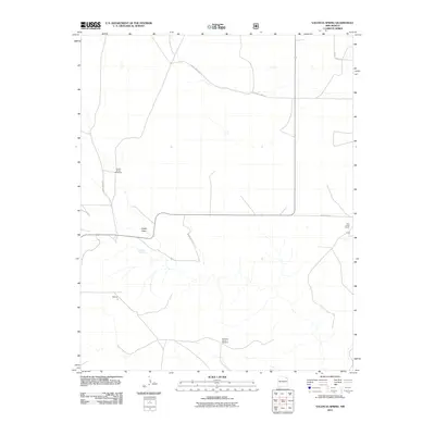
2011 Map of Valencia Spring
USGS Topo · Published 2011About this map
Valencia Spring anchors this portion of Harding County, marking a vital water source in the high plains of northeastern New Mexico. The landscape is defined by the ephemeral drainage of Spear Draw and the critical infrastructure of cattle ranching, as seen in the distributed network of Carrizo Camp Windmills and the Branding Corral Windmill. These features indicate a ranching economy that relies on tapping groundwater to sustain livestock across wide pastures. Small outposts such as Mitchell, Clavel, and Twin Creek Ranch are connected by a grid of rural roads, including County Road Z and County Road Y. This survey captures the enduring character of the state's eastern plains, where the location of springs and man-made windmills dictates the pattern of human activity and settlement.
Find a feature on this map
13 named features on this map. Tap any name to fly to it.
Don’t see what you’re looking for? This feature index may not catch every label — zoom into the map to look around manually.
Map Details
Editions of this 2011 Valencia Spring Map
This is the sole edition of this map. No revisions or reprints were ever made.
Other maps of this area

1954 · Santa Fe
USGS Topo · 1:250,000

1954 · Raton
USGS Topo · 1:250,000

1954 · Tucumcari
USGS Topo · 1:250,000

1954 · Dalhart
USGS Topo · 1:250,000

1958 · Raton
USGS Topo · 1:250,000

1958 · Santa Fe
USGS Topo · 1:250,000

1958 · Tucumcari
USGS Topo · 1:250,000

1958 · Dalhart
USGS Topo · 1:250,000

1962 · Dalhart
USGS Topo · 1:250,000

1973 · Yates SE
USGS Topo · 1:24,000