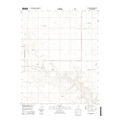
2013 Map of Valencia Spring
USGS Topo · Published 2013About this map
Twin Creek Ranch and the small settlement of Clavel sit on this plateau in the northeastern reaches of New Mexico. The landscape is defined by the water sources necessary for high-plains ranching, including the Carrizo Camp Windmills. These agricultural hubs are connected by a sparse network of county roads and state routes, reflecting the late 20th and early 21st-century land use of this remote portion of Harding County. The map provides a detailed view of the cadastral divisions and topographic contours that dictate the location of ranching operations and water management features in this arid environment.
Find a feature on this map
3 named features on this map. Tap any name to fly to it.
Don’t see what you’re looking for? This feature index may not catch every label — zoom into the map to look around manually.
Map Details
Editions of this 2013 Valencia Spring Map
This is the sole edition of this map. No revisions or reprints were ever made.
Other maps of this area

1954 · Santa Fe
USGS Topo · 1:250,000

1954 · Raton
USGS Topo · 1:250,000

1954 · Tucumcari
USGS Topo · 1:250,000

1954 · Dalhart
USGS Topo · 1:250,000

1958 · Raton
USGS Topo · 1:250,000

1958 · Santa Fe
USGS Topo · 1:250,000

1958 · Tucumcari
USGS Topo · 1:250,000

1958 · Dalhart
USGS Topo · 1:250,000

1962 · Dalhart
USGS Topo · 1:250,000

1973 · Yates SE
USGS Topo · 1:24,000