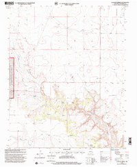
1998 Map of Valencia Spring
USGS Topo · Published 2001About this map
Kiowa National Grassland dominates the western edge of this landscape, where the terrain breaks from the high plateau into a complex network of canyons and draws. This arid environment is defined by its water sources, with several named springs such as Valencia Spring, Virgin Spring, and El Toro Spring tucked into the drainages of Carrizo Creek. The presence of Carrizo Camp Windmills and Branding Corral Windmill suggests a persistent ranching economy reliant on groundwater to sustain livestock across these high plains. Genealogists and local historians can locate the Carrizo Ch Cem, a quiet landmark of the area's early community life. In the north, Alamocita Cr and various Wells indicate the scattered infrastructure of this remote portion of New Mexico at the end of the twentieth century.
Find a feature on this map
17 named features on this map. Tap any name to fly to it.
Don’t see what you’re looking for? This feature index may not catch every label — zoom into the map to look around manually.
Map Details
Editions of this 1998 Valencia Spring Map
This is the sole edition of this map. No revisions or reprints were ever made.
Other maps of this area

1954 · Santa Fe
USGS Topo · 1:250,000

1954 · Raton
USGS Topo · 1:250,000

1954 · Tucumcari
USGS Topo · 1:250,000

1954 · Dalhart
USGS Topo · 1:250,000

1958 · Raton
USGS Topo · 1:250,000

1958 · Santa Fe
USGS Topo · 1:250,000

1958 · Tucumcari
USGS Topo · 1:250,000

1958 · Dalhart
USGS Topo · 1:250,000

1962 · Dalhart
USGS Topo · 1:250,000

1973 · Yates SE
USGS Topo · 1:24,000