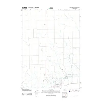
2011 Map of Valentine North
USGS Topo · Published 2011About this map
Valentine anchors the southern edge of this landscape, situated along the winding course of Minnechaduza Creek. The geography here is defined by water management and conservation, notably featuring the Valentine State Fish Hatchery and several localized water bodies such as Hatchery Lake, the Mill Pond, and Valentine Reservoir. These features, supported by infrastructure like the Valentine City Park Dam and Pierce Milling Plant Dam, illustrate how the community utilized the creek for both utility and recreation.
Find a feature on this map
21 named features on this map. Tap any name to fly to it.
Don’t see what you’re looking for? This feature index may not catch every label — zoom into the map to look around manually.
Map Details
Editions of this 2011 Valentine North Map
This is the sole edition of this map. No revisions or reprints were ever made.
Other maps of this area

1950 · Sparks
USGS Topo · 1:62,500

1950 · Valentine
USGS Topo · 1:62,500

1955 · Martin
USGS Topo · 1:250,000

1957 · Valentine
USGS Topo · 1:250,000

1958 · Martin
USGS Topo · 1:250,000

1959 · Valentine
USGS Topo · 1:250,000

1969 · Olsonville SW
USGS Topo · 1:24,000

1982 · Olsonville SE
USGS Topo · 1:24,000
1982 · Littleburg
USGS Topo · 1:24,000

1982 · Mission
USGS Topo · 1:100,000