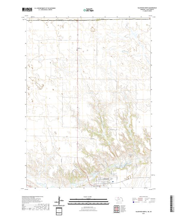
2021 Map of Valentine North
USGS Topo · Published 2021About this map
Valentine serves as the focal point of this survey along the southern edge of the Nebraska-South Dakota border. The landscape is defined by the winding course of Minnechaduza Cr and the complex drainage systems of Government Canyon. Local infrastructure and civic life are anchored by the Cherry County Courthouse and the historic Richland Harmony Cem located to the north.
Find a feature on this map
41 named features on this map. Tap any name to fly to it.
Don’t see what you’re looking for? This feature index may not catch every label — zoom into the map to look around manually.
Map Details
Editions of this 2021 Valentine North Map
This is the sole edition of this map. No revisions or reprints were ever made.
Other maps of this area

1950 · Sparks
USGS Topo · 1:62,500

1950 · Valentine
USGS Topo · 1:62,500

1955 · Martin
USGS Topo · 1:250,000

1957 · Valentine
USGS Topo · 1:250,000

1958 · Martin
USGS Topo · 1:250,000

1959 · Valentine
USGS Topo · 1:250,000

1969 · Olsonville SW
USGS Topo · 1:24,000

1982 · Olsonville SE
USGS Topo · 1:24,000
1982 · Littleburg
USGS Topo · 1:24,000

1982 · Mission
USGS Topo · 1:100,000