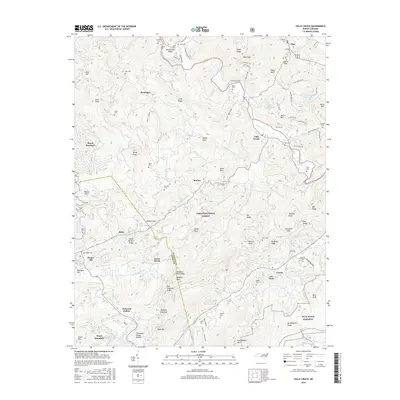
2016 Map of Valle Crucis
USGS Topo · Published 2016About this map
The Watauga River winds through this high-elevation terrain where the border of Watauga Co and Avery Co follows the prominent Tennessee Valley Divide. This landscape is defined by its deep hollows and steep ridges, including Beaverdam Ridge and Hanging Rock Ridge, which shaped the early settlement patterns and mountain agriculture of communities like Valle Crucis and Banner Elk. The area's cultural history is meticulously documented through numerous family burial grounds, such as Farthing Cem, Mast Cem, and Hicks Cem, providing essential data for genealogical research.
Find a feature on this map
123 named features on this map. Tap any name to fly to it.
Don’t see what you’re looking for? This feature index may not catch every label — zoom into the map to look around manually.
Map Details
Editions of this 2016 Valle Crucis Map
This is the sole edition of this map. No revisions or reprints were ever made.
Other maps of this area

1893 · Cranberry
USGS Topo · 1:125,000

1895 · Cranberry
USGS Topo · 1:125,000

1899 · Cranberry
USGS Topo · 1:125,000

1902 · Cranberry
USGS Topo · 1:125,000

1934 · Valle Crucis
USGS Topo · 1:24,000

1934 · Elk Park
USGS Topo · 1:24,000

1934 · Boone
USGS Topo · 1:24,000

1934 · Newland
USGS Topo · 1:24,000

1935 · Doe Mountain
USGS Topo · 1:48,000

1935 · Sherwood
USGS Topo · 1:24,000