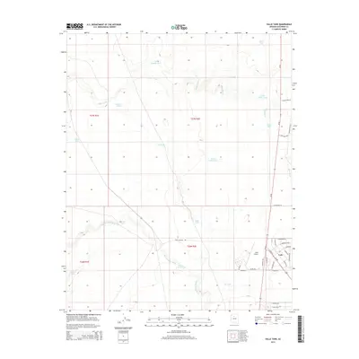
2014 Map of Valle Tank
USGS Topo · Published 2014About this map
Valle serves as a critical high-desert junction where the high desert plateau meets the infrastructure of northern Arizona travel. This 2014 survey centers on the settlement and the Valle Airport, illustrating the grid-like residential development southeast of the runway near the intersection of Us-180 and Az-64. The landscape is defined by the ephemeral drainages of Spring Valley Wash and Miller Wash, which are punctuated by a network of cattle tanks and water catchments essential for ranching in this arid environment. Named features like Sheep Tank, Cow Tank, and Little Wagner Tank demonstrate the long-standing reliance on surface water management. This map documents the transition from open grazing land to a more structured roadside community, with local street names such as E Cimmaron Strip and S Overland Trl reflecting the region's historical ranching and travel roots.
Find a feature on this map
46 named features on this map. Tap any name to fly to it.
Don’t see what you’re looking for? This feature index may not catch every label — zoom into the map to look around manually.
Map Details
Editions of this 2014 Valle Tank Map
This is the sole edition of this map. No revisions or reprints were ever made.
Other maps of this area

1886 · Chino
USGS Topo · 1:250,000

1891 · Chino
USGS Topo · 1:250,000

1948 · Williams
USGS Topo · 1:250,000

1954 · Williams
USGS Topo · 1:250,000
1956 · Red Butte SE
USGS Topo · 1:24,000

1956 · Williams
USGS Topo · 1:250,000

1960 · Williams
USGS Topo · 1:250,000

1961 · Williams
USGS Topo · 1:250,000

1962 · Valle
USGS Topo · 1:62,500
1979 · Red Butte
USGS Topo · 1:24,000