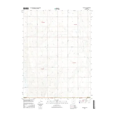
2016 Map of Vallery SE
USGS Topo · Published 2016About this map
The high plains border of Morgan and Adams counties is defined here by a precise grid of rural section lines and deep-cut drainage patterns. Morgan Co Adams Co marks the southern limit of this 2016 survey, where the seasonal waters of Sand Arroyo Cr and Badger Cr weave through the landscape. The infrastructure reflects a long history of overland travel and ranching, anchored by significant thoroughfares like Seventeenmile Rd and Twelvemile Rd. These names suggest the distances traveled by early settlers across the open terrain. The map meticulously documents the transition from the T1N R58W township into the surrounding ranges, providing a clear view of the county line’s interface with established routes like Sherman Street Rd and various numbered county roads.
Find a feature on this map
28 named features on this map. Tap any name to fly to it.
Don’t see what you’re looking for? This feature index may not catch every label — zoom into the map to look around manually.
Map Details
Editions of this 2016 Vallery SE Map
This is the sole edition of this map. No revisions or reprints were ever made.
Other maps of this area

1954 · Limon
USGS Topo · 1:250,000

1954 · Sterling
USGS Topo · 1:250,000

1957 · Limon
USGS Topo · 1:250,000

1958 · Limon
USGS Topo · 1:250,000

1958 · Sterling
USGS Topo · 1:250,000

1963 · Lamb
USGS Topo · 1:24,000

1963 · Round Top
USGS Topo · 1:24,000

1963 · Vallery
USGS Topo · 1:24,000

1963 · Adena
USGS Topo · 1:24,000

1965 · Vallery SE
USGS Topo · 1:24,000