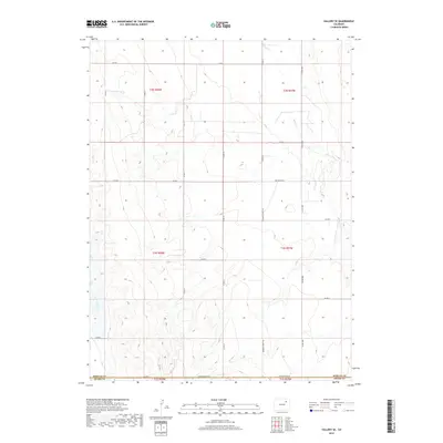
2019 Map of Vallery SE
USGS Topo · Published 2019About this map
Badger Cr and Sand Arroyo Cr carve subtle drainage patterns across this high plains landscape on the border of Morgan Co and Adams Co. The area is defined by a rigorous section-line road network typical of Colorado's eastern agricultural regions, featuring long-distance thoroughfares such as Seventeenmile Rd and Twelvemile Rd. These named routes, along with Sherman Street Rd, suggest the early importance of these corridors for connecting the scattered ranching and farming operations of the Ninemile Corner vicinity. The terrain is marked by gentle undulations and ephemeral watercourses, providing a clear look at the large-scale land management and township-and-range surveying that shaped the development of the region's rural infrastructure and property boundaries during this era.
Find a feature on this map
27 named features on this map. Tap any name to fly to it.
Don’t see what you’re looking for? This feature index may not catch every label — zoom into the map to look around manually.
Map Details
Editions of this 2019 Vallery SE Map
This is the sole edition of this map. No revisions or reprints were ever made.
Other maps of this area

1954 · Limon
USGS Topo · 1:250,000

1954 · Sterling
USGS Topo · 1:250,000

1957 · Limon
USGS Topo · 1:250,000

1958 · Limon
USGS Topo · 1:250,000

1958 · Sterling
USGS Topo · 1:250,000

1963 · Lamb
USGS Topo · 1:24,000

1963 · Round Top
USGS Topo · 1:24,000

1963 · Vallery
USGS Topo · 1:24,000

1963 · Adena
USGS Topo · 1:24,000

1965 · Vallery SE
USGS Topo · 1:24,000