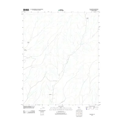
2012 Map of Valleton
USGS Topo · Published 2012About this map
Valleton stands as a focal point in this southern Monterey County landscape, where the drainage of Big Sandy Cr dictates the local geography. The map reveals a network of canyons and valleys, most notably Walters Canyon and the broad Medford Valley to the north. Transportation in this era relied on rural routes like Indian Valley Rd and Hare Canyon Rd, which navigate the winding riparian corridors and rising terrain. The presence of Cañada Montuosa reflects the deep-rooted regional history of land grants and Spanish naming conventions that persist in the modern topography. This map documents a quiet, sparsely populated region defined by its hydrology and traditional ranching access roads such as Cross Country Rd.
Find a feature on this map
8 named features on this map. Tap any name to fly to it.
Don’t see what you’re looking for? This feature index may not catch every label — zoom into the map to look around manually.
Map Details
Editions of this 2012 Valleton Map
This is the sole edition of this map. No revisions or reprints were ever made.
Other maps of this area

1915 · Priest Valley
USGS Topo · 1:125,000

1919 · San Miguel
USGS Topo · 1:62,500

1919 · Bradley
USGS Topo · 1:62,500

1941 · Priest Valley
USGS Topo · 1:62,500

1941 · San Ardo
USGS Topo · 1:62,500

1941 · Bradley
USGS Topo · 1:62,500

1943 · San Ardo
USGS Topo · 1:62,500

1944 · Priest Valley
USGS Topo · 1:62,500

1947 · San Luis Obispo
USGS Topo · 1:250,000

1947 · San Miguel
USGS Topo · 1:62,500