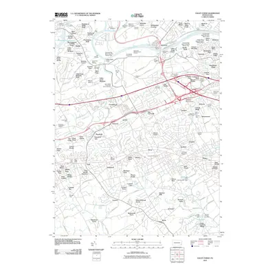
2010 Map of Valley Forge
USGS Topo · Published 2010About this map
The Schuylkill River and its major tributaries, including Perkiomen Creek and Valley Creek, define the topography of this southeastern Pennsylvania landscape. In the north, the Mill Grove Museum of John Audubon and Washingtons Crossing mark areas of significant historical preservation near the riverbanks. The legacy of the American Revolution is deeply embedded in the terrain, with landmarks such as Star Redoubt Number One, the Memorial Arch, and the Knox-Valley Forge Dam Covered Bridge scattered across the slopes of Mount Joy and Mount Misery.
Find a feature on this map
196 named features on this map. Tap any name to fly to it.
Don’t see what you’re looking for? This feature index may not catch every label — zoom into the map to look around manually.
Map Details
Editions of this 2010 Valley Forge Map
This is the sole edition of this map. No revisions or reprints were ever made.
Other maps of this area

1894 · Chester
USGS Topo · 1:62,500

1894 · Norristown
USGS Topo · 1:62,500

1895 · Norristown
USGS Topo · 1:62,500

1896 · Norristown
USGS Topo · 1:62,500

1896 · Chester
USGS Topo · 1:62,500

1898 · Chester
USGS Topo · 1:62,500

1901 · Camden
USGS Topo · 1:125,000

1901 · West Chester
USGS Topo · 1:62,500

1904 · West Chester
USGS Topo · 1:62,500

1906 · Phoenixville
USGS Topo · 1:62,500
Featured Places
- Radnor Township, PA
- King of Prussia, Upper Merion Township
- Willistown Township, PA
- Charlestown Township, PA
- Chesterbrook, Tredyffrin Township