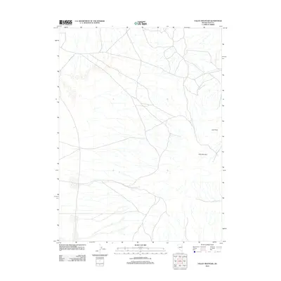
2012 Map of Valley Mountain
USGS Topo · Published 2012About this map
Valley Mountain and the high desert terrain of eastern Elko County define this landscape as it appeared in the early 21st century. The topographic survey illustrates a sparse, arid environment where water is the primary geographic driver, notably along the drainage of Drakes Creek. A large portion of the southwestern quadrant is occupied by the expansive Butte Vly, a significant regional depression that shapes local travel and hydrology. For those tracing the geography of northeastern Nevada, the map identifies specific high-elevation points such as Lone Butte, providing a detailed look at the relief and road networks that cross this section of the Great Basin.
Find a feature on this map
4 named features on this map. Tap any name to fly to it.
Don’t see what you’re looking for? This feature index may not catch every label — zoom into the map to look around manually.
Map Details
Editions of this 2012 Valley Mountain Map
This is the sole edition of this map. No revisions or reprints were ever made.
Other maps of this area

1935 · Halleck
USGS Topo · 1:125,000

1953 · Spruce Mountain
USGS Topo · 1:62,500

1955 · Elko
USGS Topo · 1:250,000

1958 · Elko
USGS Topo · 1:250,000

1962 · Elko
USGS Topo · 1:250,000

1965 · Elko
USGS Topo · 1:250,000
1984 · Arizona Spring
USGS Topo · 1:24,000
1984 · Ruby City Creek
USGS Topo · 1:24,000

1984 · West of Delcer Buttes
USGS Topo · 1:24,000

1984 · Valley Mtn
USGS Topo · 1:24,000