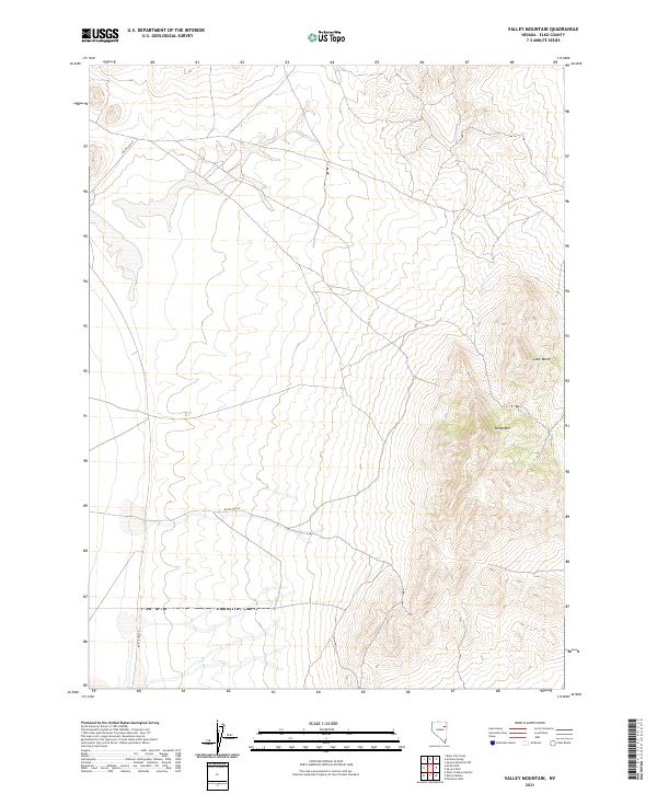
2021 Map of Valley Mountain
USGS Topo · Published 2021About this map
Butte Valley dominates the western half of this Elko County quadrangle, showing the characteristic basin and range landscape of northeastern Nevada. The terrain shifts from the level valley floor to the rising elevations of the eastern foothills, where Valley Mtn and Lone Butte stand as prominent landmarks. This 2021 survey by the U.S. Geological Survey details the high-desert environment where intermittent water sources like Prakes Cr provide the primary drainage from the mountain slopes. The map traces the intersection of several public land survey sections, including t31n r61e and t31n r62e, illustrating the vast, unpopulated character of this part of the Great Basin.
Find a feature on this map
10 named features on this map. Tap any name to fly to it.
Don’t see what you’re looking for? This feature index may not catch every label — zoom into the map to look around manually.
Map Details
Editions of this 2021 Valley Mountain Map
This is the sole edition of this map. No revisions or reprints were ever made.
Other maps of this area

1935 · Halleck
USGS Topo · 1:125,000

1953 · Spruce Mountain
USGS Topo · 1:62,500

1955 · Elko
USGS Topo · 1:250,000

1958 · Elko
USGS Topo · 1:250,000

1962 · Elko
USGS Topo · 1:250,000

1965 · Elko
USGS Topo · 1:250,000
1984 · Arizona Spring
USGS Topo · 1:24,000
1984 · Ruby City Creek
USGS Topo · 1:24,000

1984 · West of Delcer Buttes
USGS Topo · 1:24,000

1984 · Valley Mtn
USGS Topo · 1:24,000