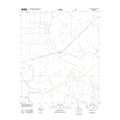
2012 Map of Valley Park
USGS Topo · Published 2012About this map
Valley Park and the nearby settlement of Little Sunflower are the primary focal points of this Issaquena County landscape, characterized by the complex hydrology of the Mississippi Delta. The Little Sunflower River winds through the center of the sheet, surrounded by a network of drainage channels and oxbows including False River, Six Mile Bayou, and Ten Mile Bayou. This 2012 survey illustrates a landscape dominated by agricultural and wildlife management priorities, as evidenced by the extensive network of rural roads like Dummy Line Rd and Spanish Fort Rd. Local infrastructure is concentrated around the Valley Park townsite, which includes a post office marked Po, while the surrounding terrain is etched with several named creeks and bayous such as Deer Cr and Cypress Bayou. The road names themselves, such as Whitten Brock Rd and Delta Wildlife Rd, hint at the local land use and family history of this river-bound region.
Find a feature on this map
22 named features on this map. Tap any name to fly to it.
Don’t see what you’re looking for? This feature index may not catch every label — zoom into the map to look around manually.
Map Details
Editions of this 2012 Valley Park Map
This is the sole edition of this map. No revisions or reprints were ever made.
Other maps of this area

1939 · Onward
USGS Topo · 1:62,500

1939 · Lorenzen
USGS Topo · 1:62,500

1940 · Mechanicsburg
USGS Topo · 1:62,500

1955 · Jackson
USGS Topo · 1:250,000

1961 · Jackson
USGS Topo · 1:250,000

1961 · Bayland
USGS Topo · 1:62,500

1962 · Jackson
USGS Topo · 1:250,000

1963 · Mechanicsburg
USGS Topo · 1:62,500

1963 · Onward
USGS Topo · 1:62,500

1964 · Lorenzen
USGS Topo · 1:62,500