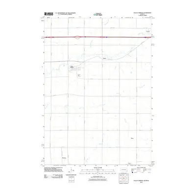
2010 Map of Valley Springs
USGS Topo · Published 2010About this map
Valley Springs sits near the border of South Dakota and Minnesota, serving as a primary hub in this agricultural region. The landscape is defined by the drainage patterns of Beaver Creek and Springwater Creek to the north, while Fourmile Creek and Blood Run carve through the southern sections. This 2010 survey illustrates the organized grid of county roads and avenues that connect small settlements like Manley, Bruce, and Benclare. For local historians and genealogists, the map preserves the locations of vital community landmarks, including Pleasant View Cemetery just south of Valley Springs and the Nerison Cemetery near the southern edge. The distribution of these sites across the township reflects the long-standing rural settlement patterns and the importance of the stream valleys in shaping the local geography.
Find a feature on this map
33 named features on this map. Tap any name to fly to it.
Don’t see what you’re looking for? This feature index may not catch every label — zoom into the map to look around manually.
Map Details
Editions of this 2010 Valley Springs Map
This is the sole edition of this map. No revisions or reprints were ever made.
Other maps of this area

1897 · Canton
USGS Topo · 1:125,000

1900 · Canton
USGS Topo · 1:125,000

1955 · Sioux Falls
USGS Topo · 1:250,000

1958 · Sioux Falls
USGS Topo · 1:250,000

1962 · Klondike
USGS Topo · 1:24,000

1962 · Brandon
USGS Topo · 1:24,000

1962 · Garretson West
USGS Topo · 1:24,000

1967 · Valley Springs
USGS Topo · 1:24,000

1967 · Garretson East
USGS Topo · 1:24,000

1967 · Hills
USGS Topo · 1:24,000