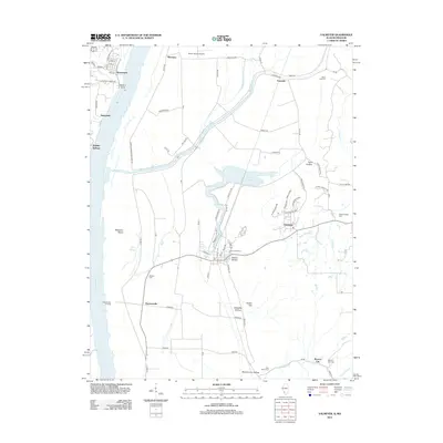
2012 Map of Valmeyer
USGS Topo · Published 2012About this map
Valmeyer and the surrounding river bottomlands are defined by their relationship with the Mississippi River, where the landscape is sculpted by drainage features like Fountain Cr and Moredock Lake. The town is positioned against the eastern bluffs, while the western side of the river features the established settlement of Kimmswick, where street names like Vine St and Mill St speak to the area’s historic core. The floodplain between the river and the bluffs is interlaced with agricultural infrastructure and protective measures such as the Corps of Engineers Levee Rd, which safeguards communities like Harrisonville. Local genealogy is well-documented through scattered burial sites including Saint Johns Cem and Wallace Cem, while the rugged bluff line is marked by named landmarks like Potato Hill and Eagle Cliff.
Find a feature on this map
85 named features on this map. Tap any name to fly to it.
Don’t see what you’re looking for? This feature index may not catch every label — zoom into the map to look around manually.
Map Details
Editions of this 2012 Valmeyer Map
This is the sole edition of this map. No revisions or reprints were ever made.
Other maps of this area

1910 · Waterloo
USGS Topo · 1:62,500

1912 · Kimmswick
USGS Topo · 1:62,500

1913 · Waterloo
USGS Topo · 1:62,500

1915 · Renault
USGS Topo · 1:62,500

1915 · Crystal City
USGS Topo · 1:62,500

1916 · Kimmswick
USGS Topo · 1:62,500

1940 · Renault
USGS Topo · 1:62,500

1948 · Kimmswick
USGS Topo · 1:62,500

1949 · Saint Louis
USGS Topo · 1:250,000

1949 · Crystal City
USGS Topo · 1:62,500