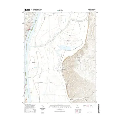
2015 Map of Valmeyer
USGS Topo · Published 2015About this map
The Mississippi River forms a wide, complex floodplain here, dividing Jefferson County, Missouri, from Monroe County, Illinois. The river is flanked by substantial landforms like Chesley Island and Meissner Island, while the Illinois side is defined by the sharp rise of the bluffs east of Moredock Lake. The village of Valmeyer sits at the foot of these bluffs, near where Dennis Hollow and Potato Hill break the elevation. This 2015 survey shows a landscape of agricultural lowlands protected by a network of levees and drainage features such as Long Slash Cr and Lucas Slough. Genealogists will find several burial sites preserved across the landscape, including Saint Johns Cem near the town center and the more remote Madonnaville Cem to the east. The map also documents small Missouri settlements along the river's western bank, including Kimmswick and Sulphur Springs.
Find a feature on this map
57 named features on this map. Tap any name to fly to it.
Don’t see what you’re looking for? This feature index may not catch every label — zoom into the map to look around manually.
Map Details
Editions of this 2015 Valmeyer Map
This is the sole edition of this map. No revisions or reprints were ever made.
Other maps of this area

1910 · Waterloo
USGS Topo · 1:62,500

1912 · Kimmswick
USGS Topo · 1:62,500

1913 · Waterloo
USGS Topo · 1:62,500

1915 · Renault
USGS Topo · 1:62,500

1915 · Crystal City
USGS Topo · 1:62,500

1916 · Kimmswick
USGS Topo · 1:62,500

1940 · Renault
USGS Topo · 1:62,500

1948 · Kimmswick
USGS Topo · 1:62,500

1949 · Saint Louis
USGS Topo · 1:250,000

1949 · Crystal City
USGS Topo · 1:62,500