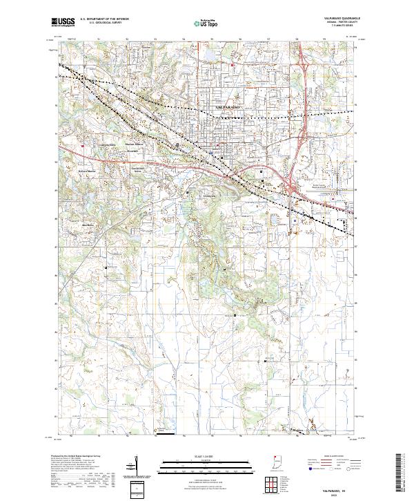
2022 Map of Valparaiso
USGS Topo · Published 2022About this map
Valparaiso serves as the focal point of this Porter County landscape, where the historic Porter County Courthouse stands as a central landmark amidst the city's residential growth. The campus of Valparaiso University and the Porter County Regional Airport signify the area's development as an educational and transportation hub. Beyond the urban center, the terrain transitions into a patchwork of residential neighborhoods like Lincoln Hills, Marian Manor, and Crestview, while the southern reaches maintain their agricultural roots near the settlement of Malden. Numerous small cemeteries, including Fleming Cem, Stoner Cem, and Adams Cem, are scattered across the quadrangle, providing a genealogical record of the region's early families. Natural drainage is defined by several watercourses such as Salt Cr, Sievers Cr, and Cobb Ditch, which cut through the moraine landscape toward the southern plains.
Find a feature on this map
62 named features on this map. Tap any name to fly to it.
Don’t see what you’re looking for? This feature index may not catch every label — zoom into the map to look around manually.
Map Details
Editions of this 2022 Valparaiso Map
This is the sole edition of this map. No revisions or reprints were ever made.
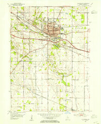
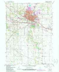
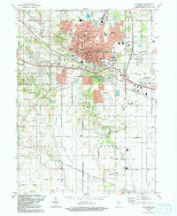
Historical Maps of Aberdeen Through Time
4 maps found