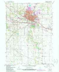
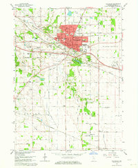
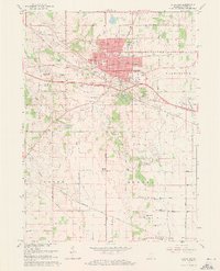
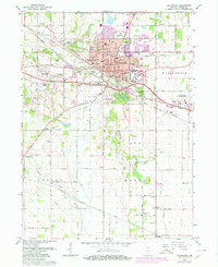
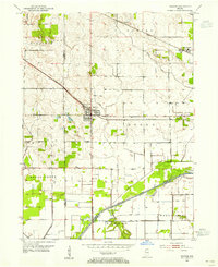
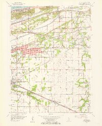
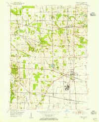
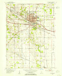
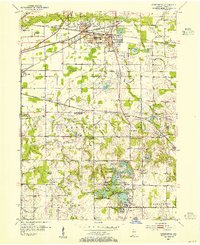
1962 Map of Valparaiso
USGS Topo · Published 1989About this map
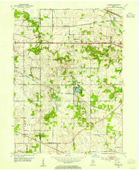
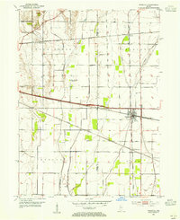
Valparaiso serves as the focal point of this Porter County landscape, showing the city's mid-century footprint alongside its 1970s suburban expansion. The campus of Valparaiso University and the Fair Grounds anchor the southeastern portion of the city, while the Chesapeake and Ohio and Norfolk and Western railroads illustrate the vital transit corridors that historically supported the region's industry.
Find a feature on this map
56 named features on this map. Tap any name to fly to it.
Don’t see what you’re looking for? This feature index may not catch every label — zoom into the map to look around manually.
Map Details
Editions of this 1962 Valparaiso Map
4 editions found
Other maps of this area
1934 · Porter
USGS Topo · 1:48,000
1940 · Porter
USGS Topo · 1:62,500
1953 · Palmer
USGS Topo · 1:24,000
1953 · Wanatah
USGS Topo · 1:24,000
1953 · Hebron
USGS Topo · 1:24,000
1953 · Garyton
USGS Topo · 1:24,000
1953 · Westville
USGS Topo · 1:24,000
1953 · Valparaiso
USGS Topo · 1:24,000
1953 · Chesterton
USGS Topo · 1:24,000
1953 · Kouts
USGS Topo · 1:24,000