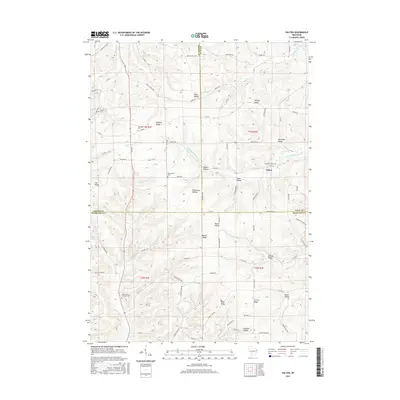
2016 Map of Valton
USGS Topo · Published 2016About this map
The Little Baraboo River winds through this rural landscape at the meeting point of Vernon, Sauk, and Richland counties. Centered around the community of Valton, the area is defined by a dense network of ridges and hollows that historically dictated settlement patterns. Family names and local history are etched into the terrain at Richardson Hollow, Mortimer Valley, and Quaker Valley, while the cemetery at Saint Patrick Lutheran Cem and the Greenwood Cem serve as focal points for genealogical research. The northern reaches include the hamlet of Debello and its eponymous Debello Ridge, highlighting how early roads like Co Rd V followed natural contours to connect these isolated valleys. From the banks of Melancthon Cr to the heights of Hickory Ridge, this survey provides a contemporary view of a region where agricultural traditions and topographical boundaries remain deeply intertwined.
Find a feature on this map
89 named features on this map. Tap any name to fly to it.
Don’t see what you’re looking for? This feature index may not catch every label — zoom into the map to look around manually.
Map Details
Editions of this 2016 Valton Map
This is the sole edition of this map. No revisions or reprints were ever made.
Other maps of this area

1905 · Richland Center
USGS Topo · 1:125,000

1927 · Hillsboro
USGS Topo · 1:62,500

1956 · Reedsburg
USGS Topo · 1:62,500

1958 · La Crosse
USGS Topo · 1:250,000

1960 · Richland Center
USGS Topo · 1:62,500

1960 · Plain
USGS Topo · 1:62,500

1961 · La Crosse
USGS Topo · 1:250,000

1965 · La Crosse
USGS Topo · 1:250,000

1966 · Hillsboro
USGS Topo · 1:62,500
1975 · Wonewoc
USGS Topo · 1:24,000