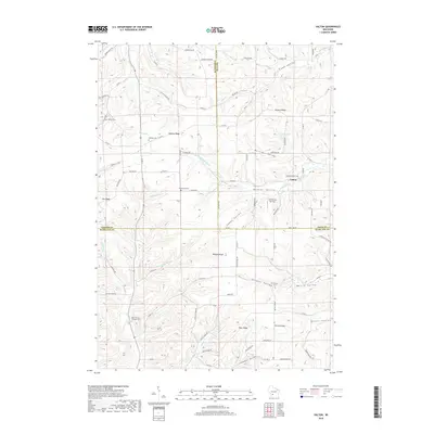
2018 Map of Valton
USGS Topo · Published 2018About this map
Valton sits at the junction of several valley systems where the Little Baraboo River and Melancthon Cr carve through a landscape of prominent ridges. This part of Wisconsin, spanning the borders of Sauk, Vernon, and Richland counties, is defined by its series of upland divides such as Debello Ridge, Hickory Ridge, and Ryan Ridge. The drainage patterns are intricate, with small tributaries like Grinsell Br and Soules Cr feeding into the larger creek systems that have shaped these agricultural valleys over generations.
Find a feature on this map
84 named features on this map. Tap any name to fly to it.
Don’t see what you’re looking for? This feature index may not catch every label — zoom into the map to look around manually.
Map Details
Editions of this 2018 Valton Map
This is the sole edition of this map. No revisions or reprints were ever made.
Other maps of this area

1905 · Richland Center
USGS Topo · 1:125,000

1927 · Hillsboro
USGS Topo · 1:62,500

1956 · Reedsburg
USGS Topo · 1:62,500

1958 · La Crosse
USGS Topo · 1:250,000

1960 · Richland Center
USGS Topo · 1:62,500

1960 · Plain
USGS Topo · 1:62,500

1961 · La Crosse
USGS Topo · 1:250,000

1965 · La Crosse
USGS Topo · 1:250,000

1966 · Hillsboro
USGS Topo · 1:62,500
1975 · Wonewoc
USGS Topo · 1:24,000