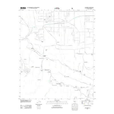
2012 Map of Valyermo
USGS Topo · Published 2012About this map
Valyermo and the surrounding high desert terrain are defined by the sharp transition from the San Gabriel Mountains down to the Antelope Valley. Significant water infrastructure dominates the northern landscape, where the Governor Edmund G Brown California Aqueduct cuts across the alluvial plains near Crystal Airport. The map documents a scattered ranching and recreational landscape, featuring named properties like Big Rock Ranch, Valyermo Ranch, and Mountain Brook Ranch that historically relied on the perennial flows of Big Rock Cr.
Find a feature on this map
67 named features on this map. Tap any name to fly to it.
Don’t see what you’re looking for? This feature index may not catch every label — zoom into the map to look around manually.
Map Details
Editions of this 2012 Valyermo Map
This is the sole edition of this map. No revisions or reprints were ever made.
Other maps of this area

1901 · Southern California Sheet No. 1
USGS Topo · 1:250,000

1903 · Rock Creek
USGS Topo · 1:62,500

1903 · San Antonio
USGS Topo · 1:62,500

1904 · Southern California Sheet No. 1
USGS Topo · 1:250,000

1930 · Black Butte
USGS Topo · 1:24,000

1930 · Llano
USGS Topo · 1:24,000

1933 · Black Butte
USGS Topo · 1:24,000

1934 · Mescal Creek
USGS Topo · 1:24,000
1934 · Llano
USGS Topo · 1:24,000
1934 · Valyermo
USGS Topo · 1:24,000