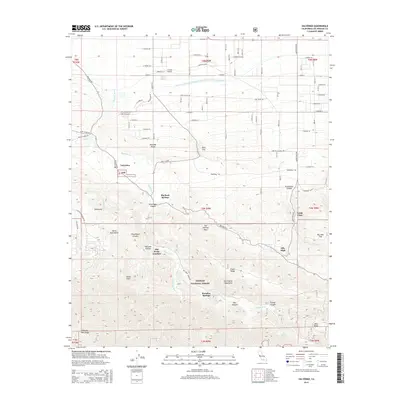
2015 Map of Valyermo
USGS Topo · Published 2015About this map
Valyermo sits at the foot of the San Gabriel Mountains in this detailed 2015 layout, marking a landscape where high desert meets steep mountain terrain. The rugged northern slopes of the range are defined by sharp geological features like the San Andreas Fault and the dramatic rock formations of the Devils Punchbowl. To the north, the infrastructure of the Governor Edmund G Brown East Branch California Aqueduct and Crystal Airport contrast with the wilder stretches of the Angeles National Forest. Small settlements and seasonal retreats such as Big Rock Springs, Paradise Springs, and Largo Vista are scattered throughout the canyons and flats, often following the drainage of Big Rock Cr. These names evoke the area's mid-century character as a getaway for those seeking the isolation of the high canyon country before the reach of modern urbanization.
Find a feature on this map
101 named features on this map. Tap any name to fly to it.
Don’t see what you’re looking for? This feature index may not catch every label — zoom into the map to look around manually.
Map Details
Editions of this 2015 Valyermo Map
This is the sole edition of this map. No revisions or reprints were ever made.
Other maps of this area

1901 · Southern California Sheet No. 1
USGS Topo · 1:250,000

1903 · Rock Creek
USGS Topo · 1:62,500

1903 · San Antonio
USGS Topo · 1:62,500

1904 · Southern California Sheet No. 1
USGS Topo · 1:250,000

1930 · Black Butte
USGS Topo · 1:24,000

1930 · Llano
USGS Topo · 1:24,000

1933 · Black Butte
USGS Topo · 1:24,000

1934 · Mescal Creek
USGS Topo · 1:24,000
1934 · Llano
USGS Topo · 1:24,000
1934 · Valyermo
USGS Topo · 1:24,000